Avalanches
In the summer and autumn, avalanche bulletins are published only in the event of heavy snowfall. Even if the SLF does not publish an avalanche bulletin, due consideration is to be given to the avalanche situation especially if snow has fallen recently.
Keep informed about the publication of unannounced Avalanche Bulletins. Activate in the App WhiteRisk the "Push Summer Bulletin".
The regular publication of avalanche bulletin recommences in November/December.
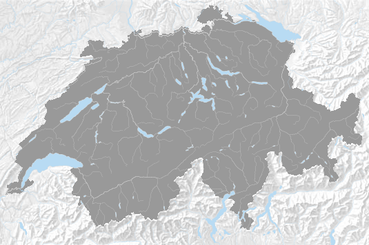
Affected regions
Adelboden, Aigle-Leysin, Ajoie, Albulatal, Alpstein – Alvier, alto Moesano, Appenzell Alps, Arolla, Avers, Basel, basso Moesano, Bernina region, Bex-Villars, Bienne - Neuchâtel, Binntal, Bisistal, Bivio, Blüemlisalp, Brienz-Interlaken, Calanda, Central Glarus, central Swiss Plateau, Conthey-Fully, Corvatsch, Davos, Delémont - Bellelay, Domleschg – Lenzerheide, Eastern Bernese Prealps, Eastern Silvretta, eastern Swiss Plateau, Emosson, Engelberg, Engstligen, Flims, Flumserberg, Franches-Montagnes, Gadmertal, Gersau, Glaubenberg, Grimsel Pass, Grindelwald, Gruyère, Gstaad, Guttannen, Génépi, Hasliberg – Rosenlaui, Haut Val de Bagnes, Hohgant, Iffigen, Jaun, Jungfrau – Schilthorn, Kandersteg, Konkordia region, La Chaux-de-Fonds - Le Locle, Laufental, Lauterbrunnen, Lenk, Leuk, Leukerbad - Lötschental, Liechtenstein, Lower Val Poschiavo, Lower Valle Leventina, Lower Valle Maggia, Lower Valleys of Visp, Lugano area, Maderanertal, Martigny-Verbier, Mattmark, Meiental, Melchtal, Mendrisio area, Montana, Monte Rosa, Monthey-Val d'Illiez, Mountet, Moutier - Tavannes, Niedersimmental, Northern Glarus, Northern Obergoms, Northern Prättigau, Northern Simplon region, Northern Tujetsch, Northern Urseren, Oberes Baselbiet, Obersaxen – Safien Valley, Obersimmental, Olten-Gösgen, Pays d'Enhaut, Pilatus, Reckingen, Rheinfelden, Rheinwald, Riederalp, Riviera, Rothenthurm, Saas Fee, Saint-Cergue, Samnaun, Sarganserland, Savognin, Schams, Schanfigg, Schreckhorn, Schwarzenberg, Schächental, Southern Glarus-Grosstal, Southern Glarus-Sernftal, Southern Obergoms, Southern Prättigau, Southern Simplon region, Southern Tujetsch, Southern Urseren, St Moritz, Stoos, Sur Tasna, Thal, Toggenburg, Turtmanntal, Upper Val Poschiavo, Upper Valle Leventina, Upper Valle Maggia, Uri Rotstock, Val Bedretto, Val Blenio, Val Bregaglia, Val Chamuera, Val d'Anniviers, Val d'Entremont-Val Ferret, Val d'Hérens, Val dal Spöl, Val de Ruz - Colombier, Val de Travers, Val Müstair, Val S-charl, Val Sumvitg, Val Suot, Vallon de Saint-Imier, Vallée de Joux, Vaud Prealps, Vouvry, Western Bernese Prealps, Western Silvretta, western Swiss Plateau, Wildhorn, Ybrig, Yverdon - Bevaix, Zermatt, Zervreila, Zuoz
4:Avalanches:-1:SLF:1111,1112,1113,1114,1121,1122,1211,1212,1213,1221,1222,1223,1224,1225,1226,1227,1228,1231,1232,1233,1234,1241,1242,1243,1244,1245,1246,1247,1311,1312,2111,2112,2121,2122,2123,2124,2131,2132,2133,2134,2211,2212,2221,2222,2223,2224,3111,3112,3113,3114,3211,3221,3222,3223,3224,3311,4111,4112,4113,4114,4115,4116,4121,4122,4123,4124,4125,4211,4212,4213,4214,4215,4221,4222,4223,4224,4225,4231,4232,4241,4242,4243,4244,5111,5112,5113,5121,5122,5123,5124,5211,5212,5214,5215,5216,5221,5222,5223,5231,5232,5233,5234,6111,6112,6113,6114,6115,6121,6122,6131,6132,6211,6212,7111,7112,7113,7114,7115,7121,7122,7123,7124,7125,7126,7211,7221,7222,7231,8111,8112,8113,8114,8211,8212,8213,8214,8215,8216,8221,8222,8223,8224,8225,8226,8227,8228,9111,9211,9311: