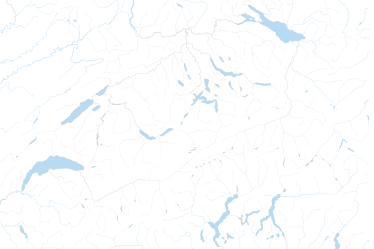
Current wind hazards
Teaser
No evaluation
Effects:
- Surface turbulence hinders light aircraft from flying;
- Waves higher than usual on lakes;
- Toppling of objects inadequately secured or free-standing objects;
- Breaking of smaller branches
Behaviour:
- Keep an eye on local weather developments
- Stay away from forests
- Secure any free-standing objects
- Always follow the official advice
Description of measurement and prognostic values:
Stormy winds in low and medium-altitude areas (incl. Foehn winds): 70-90 km/h
Effects:
- Falling branches and individual trees;
- Damage to individual roofs;
- Lightly anchored objects with larger surface areas, such as tents and scaffolding, can be blown over;
- Some disruption to road, rail, water and air traffic;
- Possible shutdown of ski lifts and cable cars.
Behaviour:
- Keep an eye on local weather developments
- Stay away from forests
- Secure any free-standing objects
- Always follow the official advice
Description of measurement and prognostic values:
- Top wind speeds in low to medium-altitude areas (incl. Foehn winds): 90-110 km/h
- Top wind speeds in higher-altitude areas (>1800 m above sea level): 130-160 km/h
Effects:
- Falling trees;
- Damage to individual buildings and roofs;
- Disruption or restriction of road, rail, water and air traffic;
- Movement of securely anchored objects with a larger surface area, such as tents and scaffolding, as well as moveable objects such as garden furniture;
- Electricity grid outages and/or failure of telephone networks
Behaviour:
- Keep an eye on local weather developments
- Stay away from forests
- Secure any free-standing objects
- Always follow the official advice
Description of measurement and prognostic values:
- Top wind speeds in low to medium-altitude areas (incl. Foehn winds): 110-140 km/h
- Top wind speeds in higher-altitude areas (>1800 m above sea level): 160-200 km/h
Effects:
- Falling trees or entire groups of trees or sections of forest as well as electricity pylons and poles;
- Severe damage to buildings;
- Road, rail, water and air traffic disrupted or at a standstill;
- Toppling of larger (empty) vehicles;
- Securely anchored objects with a larger surface area, such as tents and scaffolding, as well as moveable objects such as garden furniture etc. can be blown over;
- High waves on lakes, which wash over the banks or shores
- Electricity grid outages and/or failure of telephone networks for long periods of time and over widespread areas
Behaviour:
- Keep an eye on local weather developments
- Stay away from forests
- Secure any free-standing objects
- Always follow the official advice
Description of measurement and prognostic values:
- Top wind speeds in low to medium-altitude areas: > 140 km/h
- Top wind speeds in higher-altitude areas (>1800 m above sea level): > 200 km/h
No evaluation
-
Wind: No or minor danger, level 1
Naturgefahrenbulletin des Bundes
Ausgabedatum: Freitag, 22. Januar 2021 10:56 Uhr
Nächste Information: letzte Information
Ende Starker Föhnsturm in den Alpen
Wetter (Stand: 22.01.2021, 10:56 Uhr)
Aktuelle Situation
Die Schweiz liegt seit Mittwoch auf der Vorderseite einer umfangreichen Tiefdruckzone mit Zentrum über Grossbritannien in einer kräftigen südwestlichen Höhenströmung. Durch den grossräumigen Druckfall über Mitteleuropa hat sich damit über den Alpen eine stürmische Föhnlage eingestellt. In den bewarnten Föhntälern wurden seit Mittwochnachmittag verbreitet Windspitzen zwischen 80 und 120 km/h gemessen. In der stärksten Phase des Föhnsturms (Mittwochabend bis Donnerstagmorgen) wurde in Altdorf im Urner Reusstal sogar eine Böenspitze von 133 km/h gemessen. In der Nacht auf heute Freitag führte ein Teiltief von Westen her eine schwache Störung zur Alpennordseite, womit sich der Föhn vorübergehend abgeschwächt hat. Heute Vormittag gewann der Föhnsturm durch die Annäherung eines weiteren Teiltiefs über Südfrankreich nochmals an Stärke.
Prognose
Das erwähnte Teiltief verlagert heute Freitagnachmittag seinen Kern unter Abspaltung in Richtung Ligurisches Meer. Damit erfasst auch eine aktive Kaltfront die Alpennordseite, womit die Föhnphase zu Ende geht. In der Folge kommt es bei mässig bis starkem Südwestwind verbreitet zu Niederschlägen, die Schneefallgrenze sinkt dabei auf der Alpennordseite von etwa 1200 auf rund 500 Meter.